
Tracing an Agoura Hills Street by Address
A street search begins with an address, but an address can identify several different roles. The Assessor's situs locates the taxable parcel. A recorded deed names parties to a property interest. A permit names an applicant, owner, contractor, or designer. A reverse directory may name a subscriber for one historic year. The voter status form can verify a known registration only after last name, birthdate, house number, and ZIP are supplied. None of these records is a full household roster.
Keep a small evidence table as the street directory develops. Record the source, date checked, exact field, and role shown. That habit prevents a mailing address from being treated as a home, a permit applicant from being treated as an occupant, or a same-name deed party from being treated as the current resident.
- Run one address through the Los Angeles County Assessor Portal and save the formatted situs and AIN.
- Open the Assessor Parcel Viewer, select the anchor polygon, and note adjoining AINs one parcel at a time.
- Use the parcel key and any known party name to prepare a recorder index search at Norwalk.
- Request city planning, building, or code material by exact situs, AIN, permit, or project number.
- For an earlier household, check a verified reverse directory title and postal heading, then compare it with census and deed evidence.
This sequence makes the street directory useful without pretending that an online map can name everyone around an address. The full block and association layer belongs on the Agoura Hills neighbors page.
Normalize an Agoura Hills Address in the Assessor Portal
The Assessor portal is the best first address-normalization tool for an Agoura Hills street directory. Search by street address or ten-digit AIN, then preserve the exact situs returned. Look for the parcel status, tax-rate area, use code, land and building measures, year built or effective year, displayed roll and base-value history, and map link. The unrestricted Internet display suppresses owner name and owner mailing address, so this step identifies land rather than a person.
| AIN | Alternative text search; the ten-digit Assessor Identification Number is the stable parcel key. |
|---|---|
| Street address | Alternative address or autocomplete search; use house number, direction, and street suffix. |
| Search | Opens matching parcels and the detail page. |
| Detail tabs | Summary, map, roll or value, and characteristics vary by record. |
A formatted situs can still carry a postal label that reaches beyond the incorporated city. Compare city jurisdiction, county jurisdiction, ZIP, and parcel fields separately. For an older address, preserve the legal description too. Tract, lot, block, or metes-and-bounds language can survive a street-name change better than the modern mailing form.
The Agoura Hills sample parcel detail shows the kind of record returned by the search. Its fields include AIN, situs, use, tax geography, values, building and land characteristics, and map or district details, but not an owner name on the public display.
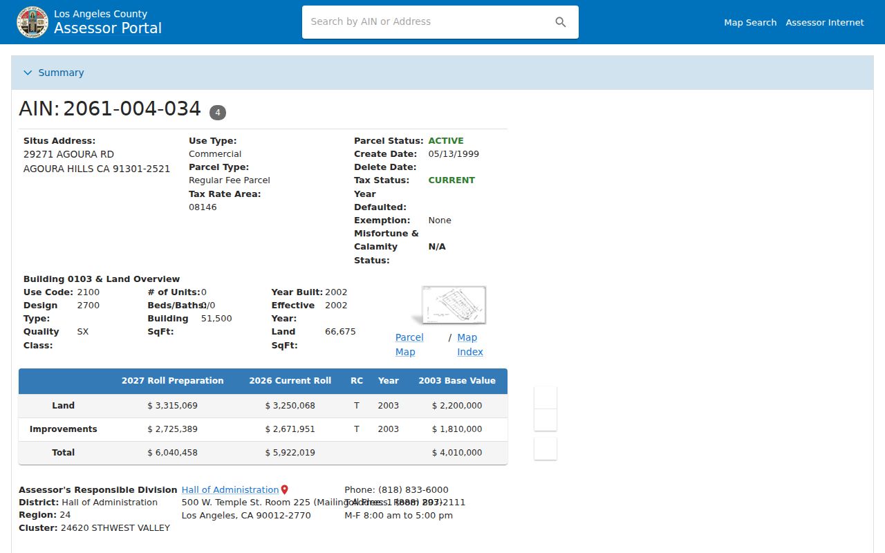
The sample parcel view is a practical street directory checkpoint: save the parcel key, then move to a record custodian that can answer the next question.
Note: A parcel detail can locate the land precisely while leaving the current household unknown.
Browse Agoura Hills Streets One Parcel at a Time
The Assessor map turns one address into a spatial chain. Search the anchor address or AIN, zoom until the parcel outline and street label are clear, click the selected polygon, and record the AIN and situs. Pan to each touching or nearby polygon and open its detail separately. The result is a parcel inventory, not a neighbor list. Map tools and context layers can change, so capture the date and the visible layer state.
The Los Angeles County Assessor Parcel Viewer is useful for geography because it joins parcel geometry to assessment data. It does not confirm occupancy, show a public roster, or replace the recorder's legal-description search. A consistent radius can be marked when the viewer offers a measure or select control, but that geometry does not create a people record.
The parcel map image shows why a street directory should keep adjacent AINs separate. Neighboring polygons can share a road, development, or mailing label while remaining distinct tax parcels.
- Parcel
- A mapped unit used for assessment; it is not the same as a household.
- Situs address
- The physical location attached to the parcel in assessment and permit systems.
- Legal description
- Tract, lot, block, or boundary language that identifies the land in a recorded instrument.
- AIN
- The Assessor Identification Number used to connect parcel detail, map geometry, and later requests.
Agoura Hills Street Records by Address
Address-keyed sources overlap, but they answer different questions. The table below keeps the street directory's roles distinct. A source belongs in the chain only when its access route and field meaning are clear.
| Record set | Keeper | What the address can show | Access |
|---|---|---|---|
| Assessor parcel | LA County Assessor | Situs, AIN, use, values, year built, characteristics | Free one-parcel search |
| Parcel map | LA County Assessor | Parcel shape, adjacent AINs, map context | Free viewer |
| Recorded instruments | LA County RR/CC | Grantors, grantees, liens, legal descriptions | Name/year index at Norwalk |
| Planning and building files | Agoura Hills | Project, applicant role, scope, status, inspection milestones | Portal, counter, or CPRA request |
| Voter status | LA County Elections | Known registration match | Four-factor verification |
| Reverse directory | Library or database | Historical listed subscriber or occupant if a title fits | Coverage must be verified |
AIN connects the parcel to the map and helps describe a city request. A party name and recording year connect the deed index to the instrument. A historical street heading connects a reverse directory to an older postal geography. Keep those links visible rather than flattening them into a single claim about who lives on the street.
Trace an Agoura Hills Deed at Norwalk
Los Angeles County does not publish its real-estate name index on the Internet. The official explanation points to privacy concerns around recorded home addresses and the difficulty of identifying protected officials in the corpus. Searchers use an alphabetical grantor or grantee index by name and recording year at Norwalk. Records from 1851 through 1957 are reviewed on the lower level, while 1958 to the present is on the second floor. Staff do not perform telephone index searches.
Begin with a known current party name and likely acquisition year. Search that person as grantee, copy the grantor, recording date, document reference, and legal description, then search the grantor as an earlier grantee. The legal description is the safety check. A street address can be similar across parcels, while tract and lot language shows whether the chain follows the same land. The recorder access notice is the source shown below for the index rule.
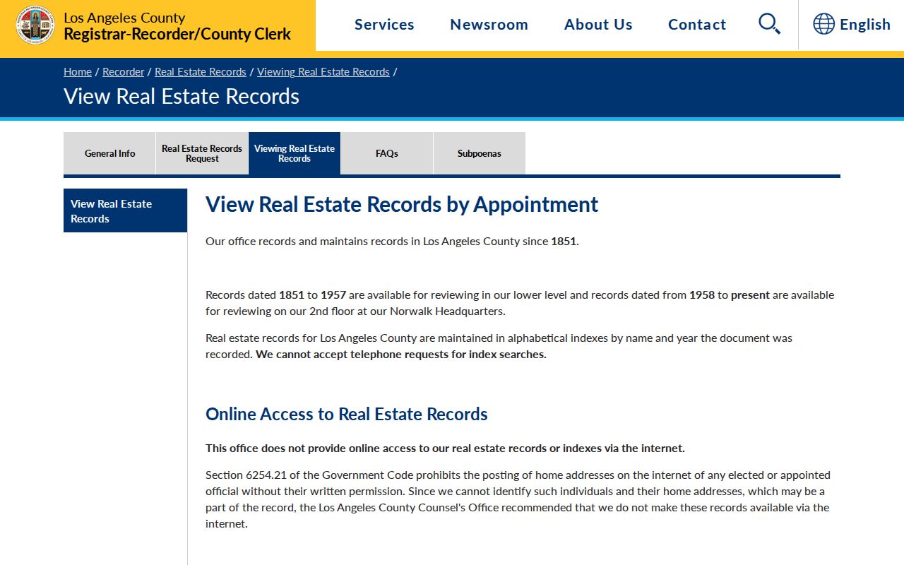
The no-online-index rule belongs in a street directory because the most important street-to-owner step happens at the county counter, not in a hidden web field.
Use the county's in-person request instructions for appointment timing and current copy rules. An index entry points to an instrument; the instrument states the transfer or interest. Deeds of trust and reconveyances describe financing activity and should not be read as automatic ownership changes.
Prepare an Agoura Hills Recorder Visit
A prepared list saves a trip. Bring the formatted situs, AIN, legal description, likely owner or seller names, and a year band. If the Assessor event history gives a recording date or transfer clue, use that date to narrow the name-and-year index. If the year is unknown, the county's mail-order instructions require each year to be searched, and a search fee applies per name and year.
At the index, distinguish grantor from grantee. A grantor conveys or encumbers an interest; a grantee receives an interest. Copy the document number or book-and-page reference, then order or inspect the identified instrument. Inventory the parties, instrument type, recording date, legal description, return address, requested-by field, signatures, notary, and any redactions. If no entry appears, test spelling and name variants before changing the parcel theory.
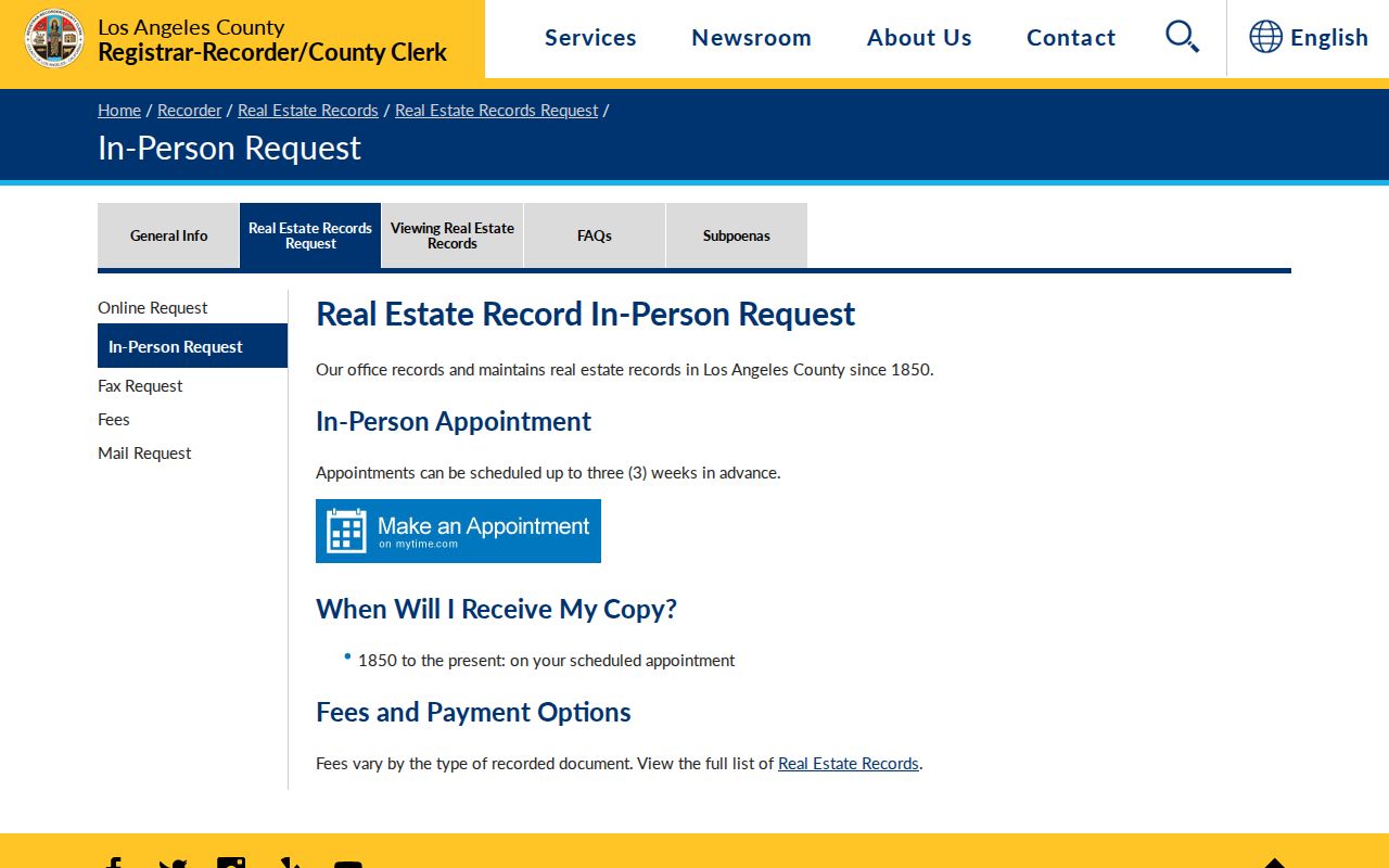
The in-person recorder route is the authoritative next step when a street directory needs a title instrument. Current fees and appointment rules should be checked before travel.
Agoura Hills Permits Date Property Events
Planning and Community Development files can make a street history more precise. Request or search by exact situs, AIN, tract or lot, permit number, project number, date span, or violation category. A file may include the application, project description, applicant and owner fields, plans, correction letters, conditions, inspection milestones, and final status. The public record may omit copyrighted plans, signatures, personal contact details, protected security material, open investigative content, or a complainant's identity.
Roles matter. An applicant can be a contractor, architect, manager, or former owner. A permit dates construction or alteration, not the full household. A final notice or closure status can explain a property event when an entire code file is not available. The city is also the right custodian for council packets, agreements, and administrative records that mention an address or project.
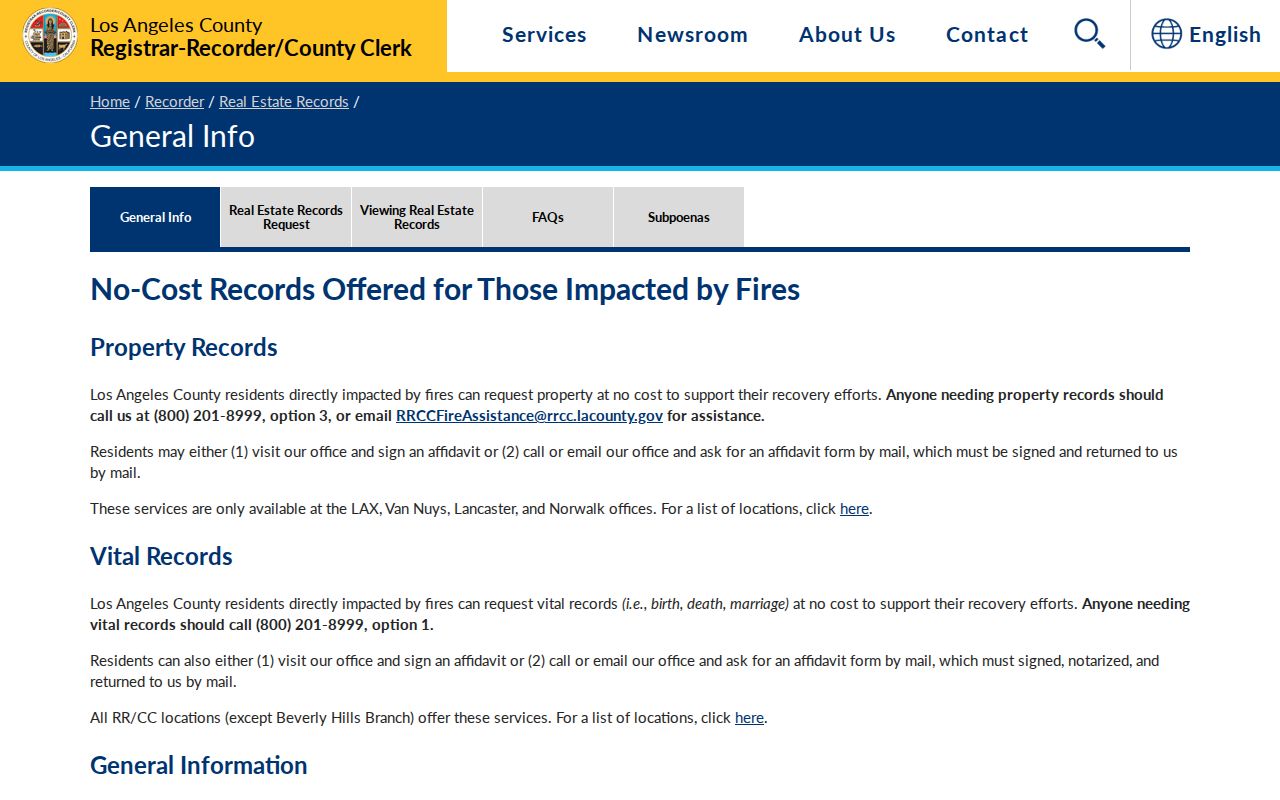
The county real-estate records hub is separate from the city permit route. Keeping those custodians separate stops a permit name from being mistaken for the person who occupied the address.
Reverse Directories and Agoura Coverage
A reverse or criss-cross directory is organized by street and number, then connects an address to a listed subscriber or occupant. It can bridge a gap between a deed and a census, but coverage is the hard question in Agoura Hills. The county library verifies nineteenth-century directories in its Californiana Collection and regional genealogy databases, while digitized Los Angeles street-reverse volumes mainly describe present-day city communities. An Agoura entry must be checked in the actual title, place heading, and year.
Read the volume's abbreviation key first. A publisher may use `h` for householder and `r` for resides, while other marks distinguish boarding, a business, or a telephone subscriber. A reverse entry can show an address and listed name without proving every person at that address. Compare it with the deed chain, census, local photographs, and city records before treating a historical street match as settled.
The older-shelf method belongs on the Agoura Hills city directory page. On a current street search, use the reverse volume as a dated clue and record the title, publisher, page, postal heading, and access location.
Agoura Hills Street History Before 1982
Agoura Hills incorporated in 1982, so earlier street evidence belongs to county or unincorporated geography. The community moved through ranch, farming, postal, and tract eras. Modern street labels can hide a parent ranch, a tract map, a changed number, or a neighboring postal place. Search the legal description and former place names alongside the current street.
Water and transport changed the pattern of settlement. Las Virgenes Municipal Water District formed in 1959, Colorado River water arrived in 1963, and the local highway became the Ventura Freeway in 1956. Those dates help explain why a sparse rural directory may give way to permits, schools, tract records, and suburban sources. They do not supply a resident list, but they guide the right record series for the era.
Note: A modern Agoura Hills street name should not be projected backward into every county deed, census, or directory heading.
Limits of an Agoura Hills Street Directory
Ordinary property records do not enumerate non-owner occupants or every household member. The voter form cannot browse a street because it requires four identity and address facts. DMV address data is restricted under the federal Driver's Privacy Protection Act. Utility subscriber data can be protected by privacy and security exemptions. Safe at Home participants, protected officials, victims, juveniles, and sealed-case parties may be absent or represented through confidential substitute information.
California Elections Code section 2194 limits voter-file use, and Penal Code section 646.9 addresses stalking conduct. A public records request should identify an existing record, not ask a city or county to investigate a person. When a street question becomes a one-person question, shift to the Agoura Hills resident lookup and keep the source, role, and date visible.
Lawful use. An Agoura Hills street directory is for personal, lawful research, family history, property curiosity, and civic transparency. Never use address records to stalk, harass, threaten, or intimidate anyone.